|
geomatica.it
Il portale degli strumenti di misura per l'edilizia e la topografia
Benvenuto! Accedi | Registrati
|
||||||
|
||||||
|
11-06-2012
Leica GeoMoS Monitoring-System Saves Human Lives
During
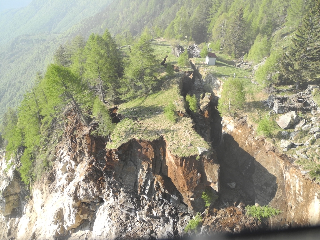
the night of 14 May 300,000 m3 of rock broke off the Valegion mountain
and crashed down 1,000 m to the valley floor in the Swiss canton of
Ticino, near the village of Preonzo. Thanks in part to Leica Geosystems’
Deformation Monitoring solution GeoMoS local authorities were able to
evacuate the valley’s industrial zone and to close the A2 highway and
several cantonal roads at an early stage.
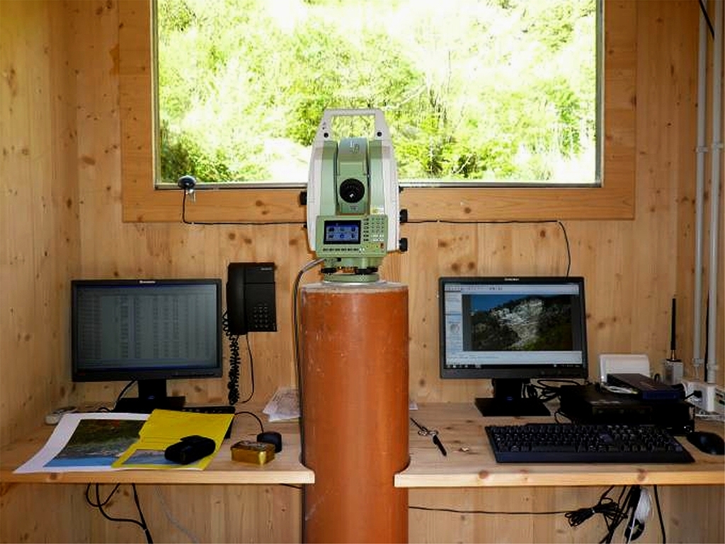
 Photo: Sezione Forestale Cantone Ticino) A Leica TM30 Monitoring Sensor monitors the danger zone on the slope.
The
Ticino community Preonzo between Biasca and Bellinzona in the canton
Ticino/Switzerland has lived with rock falls for several years. Ten
years ago, a huge rock mass slid into the valley. The Cantonal Forestry
Office has been watching the danger zone since 1998, and has been
relying on automatic monitoring systems from Leica Geosystems AG for the
past two years. Cantonal geologist Giorgio Valenti says: "We have
regularly experienced small movements over the years, especially in
spring time. Since the end of April of this year, the movements measured
have increased to several millimeters per hour, which made the safety
measures necessary."
Smallest Movements Determined from Precise 3D Data The automatic monitoring system has provided continuous information about every movement in the affected zone. Two years ago a Leica TM30 Monitoring Sensor was installed on a stable pillar below the slide area and connected to the Leica GeoMoS monitoring system. Since then the sensor has monitored 15 observation points located inside and outside the danger zone every hour, 24/7. The results are automatically forwarded to an FTP server in the Forestry Department and then analyzed by experts.  (Photo: Sezione Forestale Cantone Ticino) On 15 May, 300,000 m3 of rock crashed down from the Valegion near Preonzo / Ticino. Michael Rutschmann, Product Manager at Leica Geosystems and technical
consultant for this project, also has access to the data: "For years we
have been able to track three-dimensional data with millimeter-accuracy
in real-time, knowing when movements took place and in which direction.
The responsible experts were able to analyze developments and trends,
and combined this data with additional information. The complete
measurement history is very valuable to the geologists’ further
analysis.”
The experts were kept informed by SMS about the movements. As their speed continued to increase, it became clear that the rock would soon break off. Geodetic Monitoring Systems Help Save Human Lives Based on the analysis of Leica GeoMoS and extensometer data, the necessary safety measures could be initiated early. The industrial area at the foot of the mountain, which is important for the local economy in this region, could be evacuated in time. The police also closed cantonal roads and the highway. It could not be predicted if the mass would reach and damage the industrial zone when the one million ton load crashed down to the valley. So far no damage has been recorded, more detailed studies are yet to come.  (Photo: Sezione Forestale Cantone
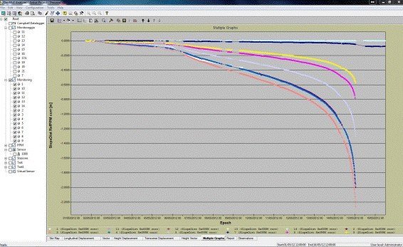
Ticino) The Automatic Deformation Monitoring software Leica GeoMoS
continuously recorded data, which helped predict the time of the rock
fall.
Current Status and Future Measures
The 70 employees of the six companies in the industrial zone have resumed their work. But even after this event in Preonzo the Leica Geosystems monitoring system will continue to monitor the slope accurately to protect the people. "More observation points will be installed in an extended zone around the fracture area, which will be continuously monitored for their stability", said Michael Rutschmann. Two years ago the community of Preonzo and the Forestry Office of the Canton Ticino (Sezione Forestale, Cantone Ticino) decided in favor of funding and commissioning an additional Leica Geosystems monitoring system to observe the area around the Valegion. |
||||||
|
TAG:
stazioni totali leica, stazione totale leica ms60, aibot drone, BLK 3D, gps topografico leica GS16, strumenti da cantiere, laser scanner blk360, stazione totale TS60, 3D laser scanner P40, laser scanner leica, sistemi di monitoraggio leica, livelli da cantiere, livelli ottici, gps gnss leica gs07, rugby leica, stazione totale leica ts13, multistation leica, palmare leica zeno 20, HDS BLK360, Leica BLK360, Laser Scanner RTC360.
|
||||||
|
|
||||||
|
© 2021 Teorema S.r.l. - P.I./C.F. 08379270153 - REA MI 1224723 - cap.soc. 100.000 € i.v. - Milano -
Condizioni di vendita -
Trattamento dei dati
Powered by Tecsia
|

